Field notes
Equilibrium line altitude, explained for a water agency
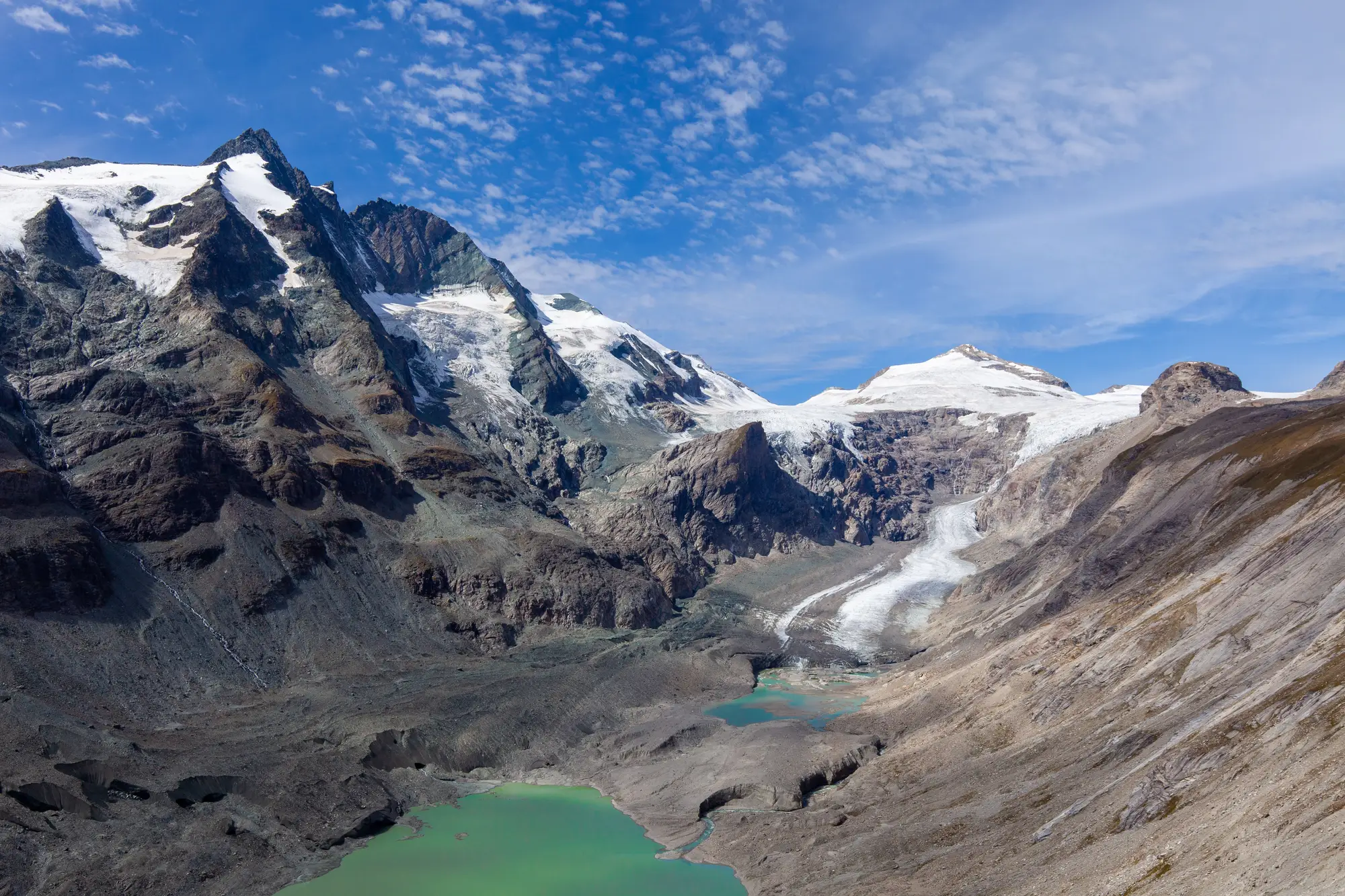
Every glaciology report on a catchment eventually mentions the equilibrium line altitude, usually shortened to ELA, and then moves on as if the term were obvious. For anyone whose job is forecasting meltwater contribution rather than studying ice sheets for a living, it's worth pausing on what the phrase actually means and why it keeps showing up in basin reports.
What the equilibrium line is
A glacier has two zones. Above a certain elevation, snowfall each winter outweighs summer melt, and the glacier gains mass. This is the accumulation zone. Below that elevation, summer melt outpaces what winter snow replaces, and the glacier loses mass. That's the ablation zone.
The equilibrium line is the boundary between them: the elevation, in a given year, where accumulation and ablation exactly balance out. Above it the glacier makes a net gain for the year, and below it a net loss.
The ELA isn't fixed. It rises in a hot, low-snow year and drops in a cold, heavy-snow one. A single year's ELA is a weather signal more than a climate one. What matters for long-range planning is the multi-year trend: if the ELA is climbing higher up the glacier year on year, a larger share of the glacier's surface area sits in the ablation zone, and the glacier is losing more mass than it's replacing.
Why a basin manager cares
Most water agencies don't commission a full mass-balance survey. The budget rarely justifies the fieldwork involved in directly measuring ice thickness change. But the ELA trend still matters for planning, because a glacier that's losing mass changes its meltwater contribution pattern over time: more melt now, less reliable melt later in the season, and eventually less overall as the ice retreats.
The practical difficulty is that ELA itself is hard to observe directly from an office. What's easier to see, season over season, is the snowline: the visible boundary between snow-covered and bare ice or rock on the glacier's surface. Read at the end of the melt season, it sits close to that year's ELA. It's not the same measurement as a ground-truthed ELA survey, and it won't give you a mass-balance number. Still, a season-by-season view of where that line sits along the glacier is a far more attainable proxy for basin planning than committing to a dedicated remote-sensing study every year.
What this doesn't tell you
Snowline extent is a surface signal. It says nothing about thickness or volume, so it won't tell you how many cubic metres of ice a glacier lost, and it can't forecast next year's melt. It reports what was observed on the last clear pass. If your hydrology model needs a mass-balance figure, that still comes from stakes, repeat elevation surveys or other fieldwork; the snowline record gives you the context around it.