Field notes
Rock glacier vs debris-covered glacier in optical imagery
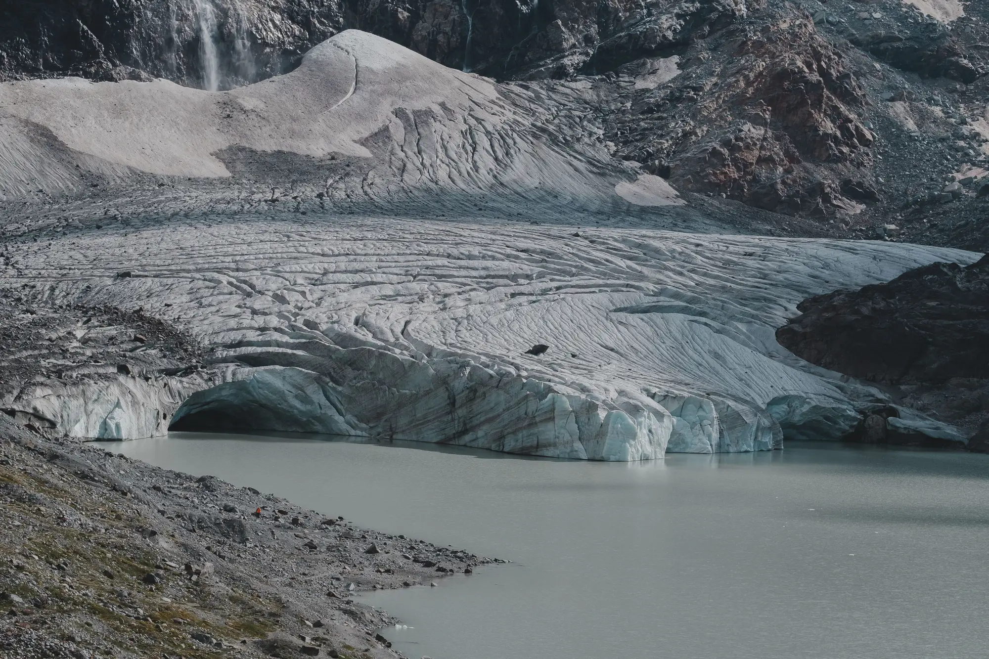
If you've pulled imagery for a glacier-fed catchment and found a lobe of rubble sitting where your delineation says "glacier," you've run into the same problem every hydrologist working in rock-mantled terrain eventually hits: debris cover and rock glaciers can look nearly identical from above, and they behave very differently in a water budget.
A debris-covered glacier is ice-cored. Supraglacial rock and till sit on top of actively flowing glacier ice, usually because rockfall or avalanche debris has been raining onto the lower tongue for decades. A rock glacier is mostly rock, ice, and interstitial permafrost creeping downslope under its own weight, sometimes with little or no buried glacier ice at all. One feeds meltwater the way you'd expect from a glacier. The other is closer to a slow-moving talus body that may or may not be contributing much to your gauge at all. Mapping one as the other skews a retreat time series and, worse, skews what you think is driving streamflow in August.
What actually separates them on screen
Start with where the feature sits relative to the rest of the ice mass. Debris-covered glaciers almost always connect upslope to a visible clean-ice accumulation zone, often through a narrow transition band where debris cover thins out and you can see crevasse traces bleeding through the till. Rock glaciers rarely show that connection. They sit lower on the slope, often fed by a cirque headwall or talus cone with no glacier above them at all, and the debris source is obvious: scree chutes and rockfall paths running straight into the body.
Surface texture is the next tell. Debris-covered ice tends to show irregular, almost chaotic hummocky terrain, pitted with supraglacial ponds, ice cliffs, and collapse features where the debris veneer is thin enough for differential melt to punch through. You'll often catch ogive-like banding or faint crevasse patterns under the rubble on a clear multispectral pass, especially late in the ablation season when ponds are at their largest. Rock glaciers, by contrast, show a much more orderly, almost corduroy surface: transverse ridges and furrows running perpendicular to flow, sometimes compared to a bulldozed washboard. That ridge-and-furrow pattern is one of the more reliable single cues once you've trained your eye on a few local examples.
Terminus shape matters too. A debris-covered glacier's front usually grades into an outwash plain or proglacial lake, often with visible meltwater channels braiding away from it. Rock glaciers tend to end in a steep, lobate front, sometimes near-vertical, with a distinct talus apron at the base and no meltwater channel network to speak of. If there's a pond right at the toe fed by a visible channel threading up into the body, you're almost certainly looking at buried ice. If the front is a steep wall of loose rock with nothing draining from it, you're probably looking at a rock glacier.
Why the seasonal archive helps more than a single scene
None of these cues are foolproof from one image. Watch the same feature across several seasons and the signal sorts itself out fast. Supraglacial ponds that grow, drain, and reform at different spots year to year are a strong debris-cover signal: that's collapse and meltwater routing changing under a thinning ice core. A rock glacier's surface furrows barely shift season to season, because what's moving is a slow permafrost creep measured in centimeters a year, not an ablating ice body.
A single scene can't give you that kind of comparison. A seasonal ice extent layer can, by tracking the same tongue across enough summers to separate "buried, melting ice" from "rock that's always looked like that." If you're trying to get a clean read on which features in your catchment are actually contributing glacial melt before you commit a season of fieldwork to ground-truthing, take a look at what Glacier Monitoring can map for your basin from the archive you already have access to.
Once you've sorted the rock glaciers out of your catchment's ice inventory, the next step is just watching the real glaciers retreat, season over season, for as long as the archive goes back.